by John Fuhring Leaving the Lake Natron Basin and journey to Camp 8 While we were eating our last breakfast at Hot Spring Camp, the tents were taken down and the luggage piled up by the Bedford. Not long after breakfast we assembled at the picket line and got ourselves ready to ride out. As mentioned, I left my camera in my day pack in the Land Rover. You see, my precious digital camera isn't waterproof and I didn't want it to get splashed or soaked if my horse went down in the turgid waters of Lake Natron. Too bad I didn't have it that morning, because it wasn't in danger of getting wet after all and I missed taking some pictures. The missed pictures were actually nothing very important, that's true, but there was an abandoned mine out there. It was a small "open pit" working with some very old machinery about. It looked like it dated to a time when both Tanganyika (modern Tanzania) and Kenya were administered by the British. I have no idea what they mined out there. The "tailings" didn't look like evaporites, but seemed to be a hard creamy white rock with an amorphous but uneven texture. Some day I'm sure I'll find out what brought miners way out there, but right now my guess is that the mine was worked for "Rare Earth" minerals that are many times associated with the kind of carbonate volcanism found in this region. In case you're wondering, Rare Earth elements are primarily used as catalysts in petroleum cracking processes (turning heavy oils into lubricating oils and gasoline). They are also used as metallurgical additives, in polishing compounds, really strong permanent magnets for magnetrons and other high frequency radio uses and colored phosphors for CRT's. A Rare Earth mine sounds pretty exotic, but the mine could have also have been a very ordinary mine that supplied clay minerals for the ceramics industry. It was interesting seeing these old works out
there and I got off my horse to look around a little, but we were soon
on our way toward our lunch stop not far away. Except for the rocky
ground near the mine, the footing wasn't too bad on the horses feet.
It probably was, but I don't remember it being particularly hot at our
lunch stop. Again Elizabeth was there to perform her usual "bush
kitchen magic."
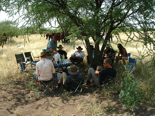 Lunch camp 8.
36 degrees, 6.405 minutes East Longitude 2009 Feet above Sea Level
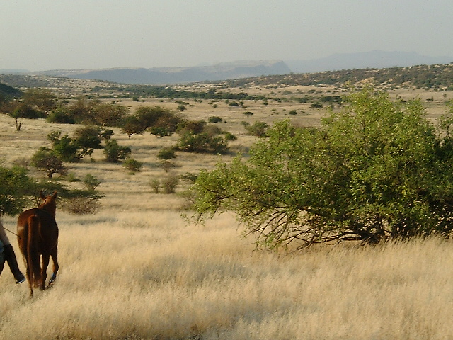
Here's something funny. All Americans know how wildly popular ice (or iced) tea is. We all know that when you are really thirsty, it is just about the best drink there is. We fix it all sorts of ways: there's the large "sun tea" brewing jugs kept outdoors for hours, we cool down large batches of hot tea in the refrigerator and, although not my favorite, there's instant ice tea in jars - very popular and marketed by Lipton and other well known brands. Arizona Tea Co., Lipton, Snapple, there must be dozens of good and successful brands of ice teas in 12 to 20 ounce bottles and cans on the market. In short, it's wonderful and popular stuff over here and especially so in hot and dry parts of the U.S.A. Would you believe that when I first asked for ice tea at lunch, the whole idea of drinking chilled tea was greeted with extreme skepticism? Never heard of it. When I asked other Europeans about it, the universal reaction was one of disgust at the very thought of drinking cold tea. I tried to get somebody to fix a batch and just try it, but no way. And yet, the highly flavorful and pleasingly reddish tea they grow so much of here in Tanzania would make the most excellent ice tea. One of these days Coke Cola or Pepsi or some other soft drink bottler here in East Africa will overcome the foolish prejudice against drinking cold tea and it will become as wildly popular as it is in America. Maybe. Anyway, I sure got sick of fizzy soft drinks and I've never liked drinking beer when I'm hot. Fizzy drinks and especially beer doesn't quench my thirst and beer actually makes me feel uncomfortably hot. Unlike a lot of Americans, I'm not normally a big ice tea drinker, but I sure would have liked to have had some out there. After another very nice lunch and a nice rest, we began the ride to our next overnight camp. Riding to the northeast, we climbed out of the Lake Natron basin and started onto the highlands of the extreme northern shoulder of Mt. Gelai. The nature of the ground changed and became harder and strewn with cobble sized volcanic rocks and nodules of flint. The cobbles were sharp and just the size to fit inside the horses hoofs. This part of the journey was about the worst on the horses' feet as anything they had experienced up to now. Seeing nodules and shards of flint out there
was somewhat of a surprise and at first I was wondering if indeed it really
was flint, but yes, it was flint. Flint forms in old soils as the
silica dissolves out and is redeposited in cavities deep in the soil.
If erosion begins and strips off the the overlying soil layers, the flint
highly resistant to erosion, is exposed on the surface. In some cases
where this occurs, the flint nodules are highly colored and you have semiprecious
Jasper and Agates, but here the flints were the common gray to cream colored
types. After realizing that much of the stuff covering the ground
was really flint, I concluded that this area was an old erosion surface.
At evening, we got to see an example of what the original soil surface
was like and how high above today's ground surface it once had been.
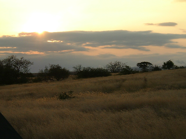
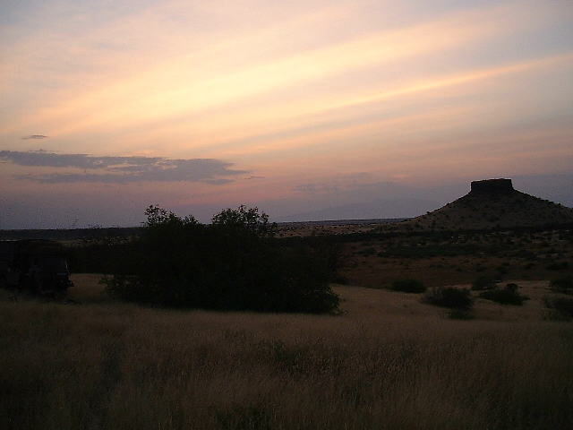
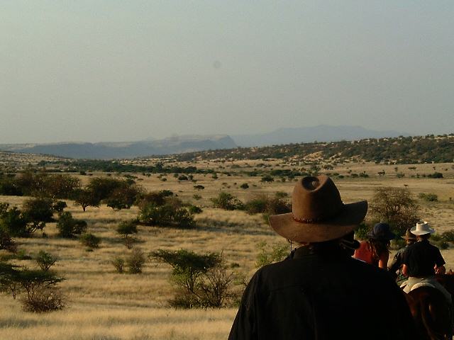 Rift Valley escarpments in the distance. 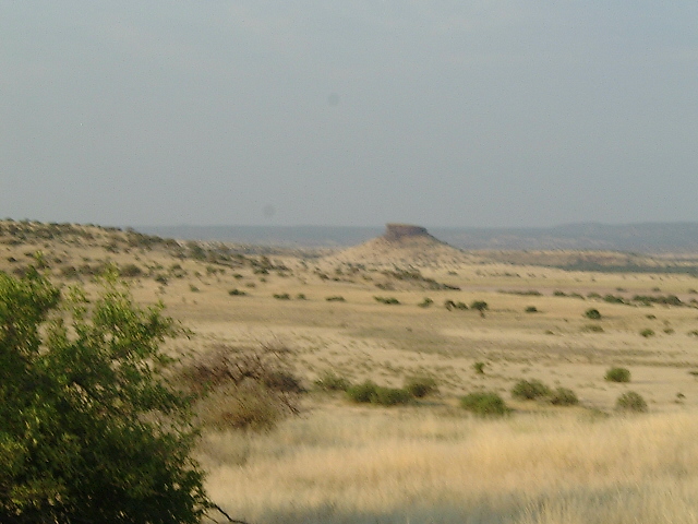 We spotted a rather unusual mesa in the distance as it was getting near sundown. 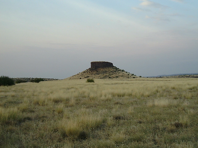 We rode on until we reached what they call "Cowboy Mesa"
The sun was low on the horizon and we could see small mesa off in the distance as we rode along. We seemed to be traveling in the general direction of this little mesa and I was hoping we'd be camping near it soon. As we passed south of it, we could see up ahead the first signs of a camp. In this story I'm calling our eighth camping site 'Camp Mesa Colorado' in honor of the red color of the outcroppings on the sides of the mesa. It looked like we'd be getting into camp at or near sundown again. Finally, just before sundown we made camp and I caught these pictures. It sure would have been nice to come into camp earlier, but at least everything was set up for us. Camp Mesa Colorado was situated on a hill slope
among some tall grass. The damn grass had seeds with sharp stickers
that would get into the cloth of your pants and your socks and cause you
to itch like mosquito bites. You know, even the grass in Africa can
be pretty miserable stuff. The slope was pretty bare of even scrub
trees and you had to hike through that tall stinging grass quite a distance
to find a modest place for your toilet. Showering was a real adventure
because it was really dark out and the bucket was located down a steep
little canyon on very slippery ground. I had a hard time keeping
my balance down there and nearly slipped and fell a couple of times, but
at least I got a good shower. I noticed that they were using the
hot springs water for the shower because my skin felt slippery as I bathed.
Supper was good as usual (never had a bad meal) and we had a nice bonfire although the tall grass caught on fire and we had a rather active time stomping it out. I ran and got the toilet shovel, but by the time I found it and started using it, the grass was pretty much out. As I remember it, it was still pretty warm inside the tent, but there didn't seem to be any mosquitos out. Even though my tent was pitched on a slope, the layout was good and my head was uphill. I think I slept OK. 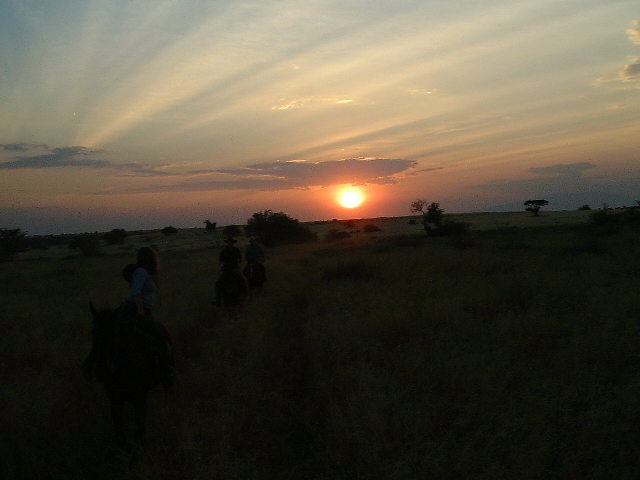 We arrived at Camp 8 as the sun was going down over the Lake Natron Basin
36 degrees, 12.002 minutes East Longitude 2316 Feet above Sea Level
 At sunrise I was still in my tent, but soon got up to take a few pictures. Looking east, the sunrise certainly wasn't as colorful as the sunset the evening before. There isn't the moisture in the sky to the east to give you those spectacular colors you get looking west towards Lake Natron.
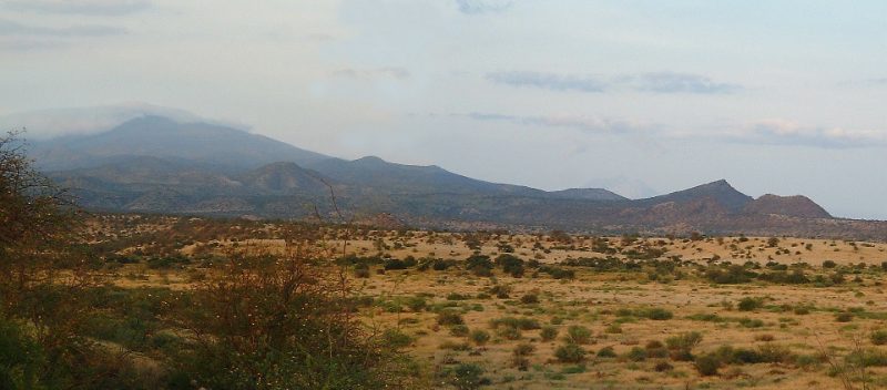
Looking southward toward Mt. Gelai, the scenery was rather beautiful and rugged. I know that there are many people who don't care for semiarid scenery. It's harsh and there's not much green to look at and it can be forbidding. If you go out there and don't have a supply of water or know where the water holes are, you could die. I love those kind of places.
Now that it was morning we had a good view of the mesa through the binoculars. It wasn't all that far away and now I really wish I would have hiked up to it. I didn't know how long it would take to get there, so I hung around camp until it was too late to go. I was 99% sure the mesa was an "erosion remnant" and the top of it was the original land surface before erosion removed all the surrounding countryside some thousands of years ago. Still, it could have been a "volcanic plug" from some old eroded volcano. The only way to know for absolutely sure was to go out to the structure and dig out some samples If the samples turned out to be solid rock from hardened lava, then it was a plug, but if there were ancient "soil profiles" in softer deposits, it would be a soil remnant from long ago. I love geology and geomorphology. Many people look at the scenery and think "isn't that pretty" but if I can fit the scenery into a larger geologic or geomorphic pattern, it is so much more enjoyable. I don't suppose you really care to know about
ancient soil profiles (paleosols), but I'll tell you anyway. In areas
where you have a stable ground surface over a long period of time without
significant erosion, the soil develops what is known as a "soil profile."
The profile is influenced by the amount of rainfall there is and how much
sand, silt and clay is in the soil to begin with and how much time the
soil has had to develop undisturbed by changes in the climate or ecology.
An old soil will develop a deep soil profile with sand and silt sized particles
on top and clay layers below. If I remember, top layer is called
the zone of aeration or (more commonly) the "top soil" and this is the
zone that supports plant and animal life. Below this layer is the
"zone of accumulation" where clay can build up, sometimes quite thickly.
This clay forms a resistant and somewhat waterproof layer. When the
land gets out of balance due to a change of climate or vegetation (like
when goats come in), the forces of erosion start to wash away the top layers
leaving the clay base exposed. Further erosion will eat down through
the clay layers and expose old rocks and flint nodules, but in areas that
have especially thick or hard clays, a mesa will form. This mesa
will be capped by erosion resistant clays and parts of the old soil profile
will be preserved at the top of the mesa. The ancient remains of
the original soil up there is called a "paleosol." The top of the
mesa is the original height of the land surface and everything you are
standing on lower than that surface would have been underground in ancient
times.
Being romantically attached to the past, I find it a really neat feeling to see at least something that remains of ancient times. By using my imagination, I can dimly visualize what a landscape must have looked like thousands of years ago or even longer. I guess that's why I like Africa so much, it's like stepping back in time 1, 2, 3 or million years ago, maybe even back to the Cretaceous to get some idea of what life looked like way back then. Ain't that dumb? 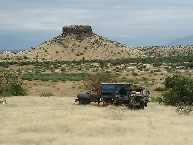 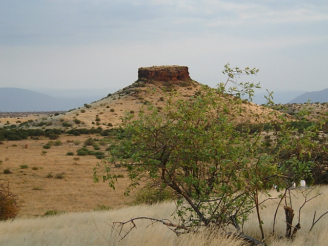 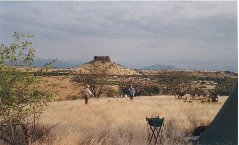
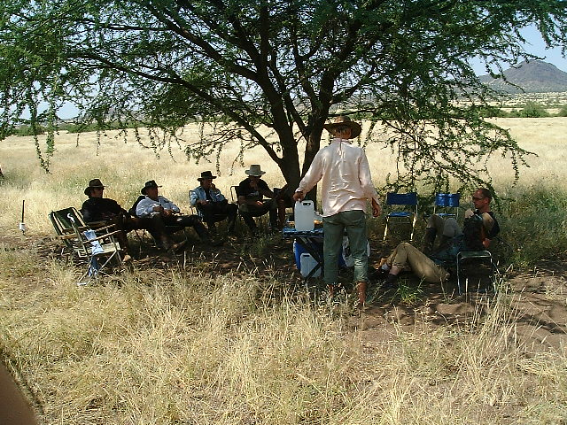
Even the grass here seemed to have thorns and it was somewhat difficult walking through it. Here Stephan and I am walking around camp. Camp 8 represented the northern apex of our
journey and now it was time to
start the long ride to the southeast that would eventually take us back
to the Farm.
|