by John Fuhring Entering the East African Rift Valley Our first few miles took us over some very rocky ground with gullies eroded deep into the earth. There were a lot of native people living in this region in their customary round mud and dung huts. Some of those huts and associated compounds were quite nice looking and I wish I would have taken more pictures. Speaking of the native's huts, I'm glad that you want to know why the natives plaster their houses with dung mixed with mud because I was going to tell you anyway. Before I get into the engineering aspects of using dung, let me give you a little background. A few years ago I kept my horses at a place where we put all the manure in big steel boxes that, when full, would be taken to a composting center and disposed of. It was expensive, but we had to do it that way. One day I noticed a family of Mexican looking fellows shoveling out the boxes and putting the manure into a dump truck. I was very glad they were taking away the manure because it would save us money, but I was curious what they were going to do with it. I went over to the oldest member of the crew and a man I thought might be the father of the others and asked him if they were gardeners and wanted the manure for fertilizer. The man was extremely polite, stopped what he was doing and said "oh no Senior, I am a master mason from (???) and I have been sent for to restore an historic adobe building near here. Now I really was curious and I asked him the connection between adobe bricks and horse manure. He said, "Oh Senior, horse manure is the very best of all manures to mix with the clay mud as it gives the most strength to the bricks." I thanked him for the information and let him get back to his labors. It was immediately obvious to me what the man was talking about. Manure from plant eating animals is just full of undigested plant fibers that readily mix with mud. Horses have about the most inefficient chewing and digestive systems of any herbivore and the plant fiber in their manure is long and coarse, so it would indeed make for the best source of fiber. If you have ever dealt with cement or fiber-glass, you know that the binder material needs a matrix of fibers or gravel and metal bars to give the overall structure strength. The right combination of fibers and binder is essential for strength because neither the matrix or the cement by itself is enough. In building their houses, the native people weave sticks together to form the framework of a hut. They then fill all the big open spaces in the wicker work with stones. Finally, they make up a plaster of mud strengthened with fibers derived from undigested plant material from their animal's droppings. It's so simple and so elegant and it works so well. Once the material has set up and hardened, it is strong, dry, odorless and as clean as any other plaster. It takes whitewash or paint very well and (if the roof doesn't leak) will last for years. Anyway, back to the story. As we rode west
the ground became less rocky
and without the deep gullies. We then rode past fields under
cultivation,
growing mostly corn (maize). After riding for some time that
morning,
we started to leave the farm fields and clusters of native huts
behind.
We were into flatland that was great for riding, but had obviously been
overgrazed by goats. The land was showing all the classic
signs of
wind and water erosion caused by too many animals grazing on too little
pasture.
Now it was early June and this is the time of the year when the Short Rains Season is pretty much over and (like my native California) the native vegetation starts drying out pretty quickly. Unlike the end of the rainy season at home, the sky here remained quite overcast most every day. Although somewhat gloomy, this overcast weather was just great for riding because the high clouds kept the hot sun hidden and it therefore it didn't beat down on you or your horse. The down side of this was that the scenery was washed out and the visibility was restricted to about 10 miles or less much of the time. There were wonderful exceptions to this though.
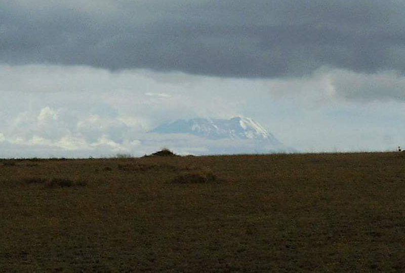
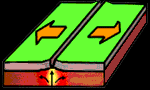
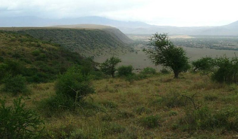
About 3/4 of the way to our first lunch stop, we had a hazy but beautiful view of Mt. Kilimanjaro about 55 miles away to the west (by GPS measurement). There was a distant ridge in the way, so we couldn't see the base of the mountain and therefore missed seeing it in all of it's glory. Still, it was a beautiful sight and we were fortunate to see it at that distance through all that overcast. Riding along we came to an escarpment with a pretty spectacular view of the Rift Valley below. Warning!! the next few paragraphs are full of nerdy geology stuff. The African Rift Valley is similar to the Basin and Range Provence of Western North America. I studied Geology and lived in Nevada several years so I'm somewhat familiar with the geology of this region. By describing what little I know of the Basin and Range, I hope to give you some insight into the Rift Valley. The Basin and Range is a geographic region of North America where tectonic forces are stretching the continental crust apart. According to the theory of Plate Tectonics, these forces are driven by huge upwelling convection cells of hot, plastic material deep below the (more or less) solid crust of the earth's surface in a zone called the mantel. Where the convection takes place along a long, globally sized zone, they call it a "spreading center" and if the spreading center is under an ocean, it forms a "midocean ridge" (like the MidAtlantic Ridge) or (like off the West Coast of America) a "rise" (the East Pacific Rise in that case). If the spreading center occurs under a land mass, you get a "rift zone" (as it's called in Africa) or (as it's called in western North America) a "Basin and Range Provence." Continental plates are ripped apart and are caused to move away from each other as the crust on either side of the spreading zone gets caught up on the "conveyor belts" of the slowly moving material of our Earth's plastic mantel. In a highly schematic form, the little animation below shows what is going on in a rift zone.
The most obvious geologic features of a rift zone are the numerous high areas and low areas that tend to line up in the same direction. These elevated blocks (called horsts) and lowered blocks (called grabins) are separated from each other by giant cracks in the earth called "normal faults." Because rift zones may be hundreds of miles wide, there are many, many horsts and grabins throughout the zone. The grabins, being the lowest in elevation may form lakes. These lakes are usually without an outlet and over thousands and thousands of years build up salts and other minerals. Over many cycles of filling and drying, these salts form thick layers of evaporites that may contain valuable minerals. The waters in these lakes are highly saturated with minerals and are totally unfit to drink. The waters support only the most salt tolerant algae and animal life (like brine shrimp). Because the crust has been stretched so thin and fractured by faults and due to the close proximity of mantel material upwelling from the very hot interior of the earth, some very strange geologic processes occur within these rift zones. Older crustal rocks are heated and their structural and mineralogical characters are changed by the process of metamorphosis to form various types of metamorphous rocks. Large gemstone crystals may form by this process within these metamorphic rocks. Mineralization may occur by chemical reaction of hot liquids in contact with old crustal rock, by the recrystallization of crustal minerals, by the leaching and redeposite of concentrates of ores by hot water solution (hydrothermal emplacement) or by mineral separation and concentration (called fractionating) in melted rock deep within the earth. Finally, where certain types of volcanic ashes are in long contact with ground water, special types of highly useful clays are formed over time. Volcanoes are common features of a rift zone as are lava flows and thick volcanic ash deposits. Depending on location, volcanic activity may take many interesting forms. Here can be found wide regions covered with thick layers of black basalt lava. These layers were formed by quiet, fluid basalt flowing from cracks in the earth and usually not from a volcanic mountain. You will see huge so-called Stratovolcanoes (traditionally known as Composite Volcanoes) formed by the build up of both "pyroclastic" ash and flows of very viscous lava (like andesite and rhyolite). Dotting the countryside and even on the sides of older volcanoes, you'll find small cinder cones made up of volcanic ash. Volcanic ash from eruptions of the composite volcanoes and from the cinder cones generally fills the valleys. In addition, there are thermal springs where ground water comes in contact with the hot interior and exits the earth still very warm. In addition to
all that "normal" volcanic activity,
the East African Rift has, by far, the largest volume of alkaline lava
deposits in the world. Indeed, the Oldoinyo Lengai volcano at
the
south end of Lake Natron is the only volcano in the world that is
actively
extruding lava rich in calcium, sodium and potassium carbonates (called
phonolites). In addition to the carbonates, Lengai's lava is
also
rich in highly alkaline sodium oxide which forms caustic soda (NaOH)
when
it comes in contact with water. This very singular lava is
rich in
gasses, but completely lacking in water vapor and the temperatures of
the
lava when it is extruded is the coolest known (less than 600
C).
This lava is so unusual, something very interesting and strange must be
going on down in the hot mantel where it is produced. Looking over the escarpment, we had a beautiful view of a dry valley below. Looking through field glasses we could see Masaai and their cattle and a tiny clump of trees way down there.
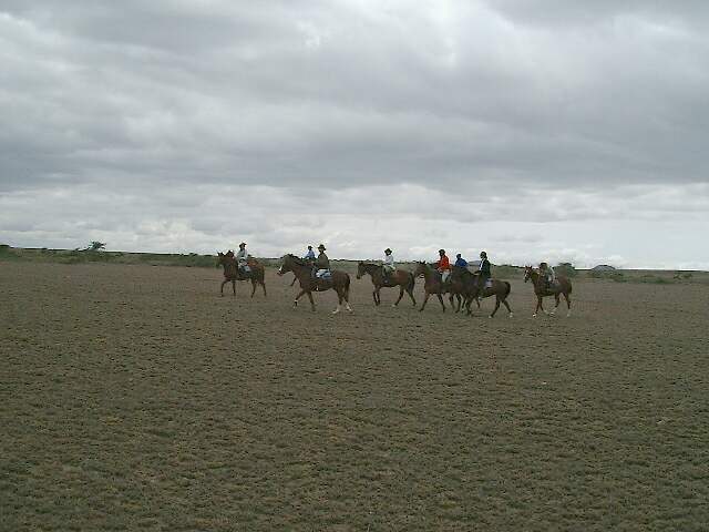
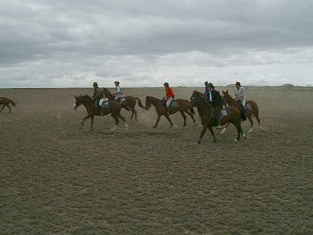
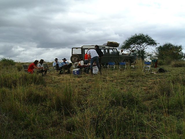
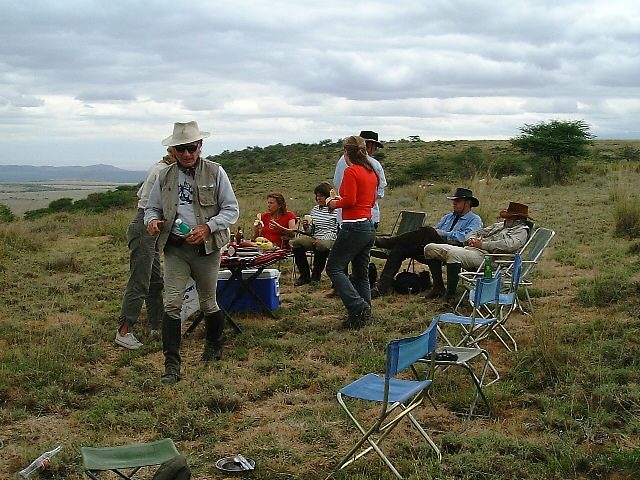
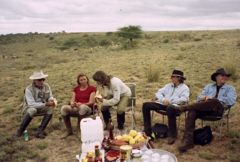
We had come a long way that morning on horseback, but the riding was pretty beeline straight. Somebody spotted Annabelle's red shirt being waved to attract our attention and we headed for our first lunch stop. Even at this early stage I could tell that things weren't going as well as on the previous safari, but I'll get into that later. Anyway, by no means did the quality of the food suffer at any time and we had a typically wonderful lunch.
3 degrees 4.956 South latitude 36 degrees 32.670 East longititude 4993 Ft. above Sea Level After resting
our butts for a couple of hours
we climbed back on the horses and started the long ride to our first
camp. |