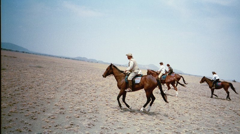
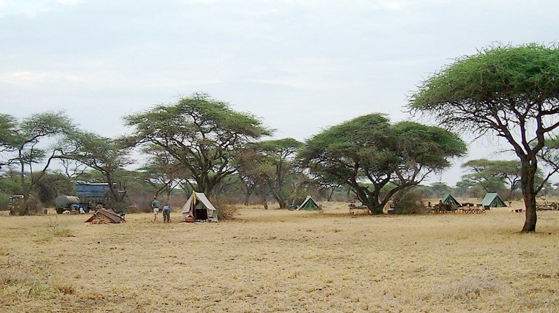
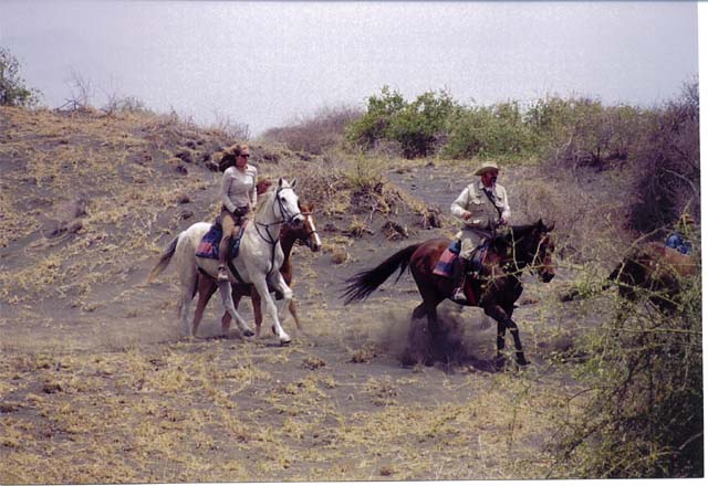
Part 1, the Horse Safari By John L. Fuhring PAGE 7 We continued to ride westward away from the Yellow Fever Trees and toward the volcanic hills of the Seven Sisters. The ground was quite open most places and the footing was pretty good. We had some good runs across the plains and Judith and I got into another race. My leg was killing me (whine, whine), but I managed to do pretty well. Lise told us, if we going to race, to go no further than a grove of trees where there might be elephants and the ground was broken and thick with underbrush. Although Judith zipped by and was ahead at first, Queen took the lead until I saw the trees coming up and checked her. Judith zipped by me and I couldn't understand why she kept going at such a high speed through (what I considered) dangerous terrain. When Judith finally got turned around and joined us, we found out that she hadn't really meant to race at all. There was something amiss with her horse's bit and she had almost no control of the horse. Now that it was over and everybody was OK, I allowed myself to find the situation pretty funny.
Around noon time I checked our position with my GPS receiver because the area was looking vaguely familiar to me. The magical little device told me that were less than a mile and a half (2 KM) from Lunch Camp 3 (of three days ago). I looked in the direction the GPS pointed to and sure enough, I could see the trees and clearing way in the distance and it did indeed look familiar to me. Like the big mouth I am, I started to tell people that we'd be stopping for lunch in just a few minutes. Evidently Queen (who was riderless at this time) thought we were going to have lunch there too because she took off at a dead run for the grove (do you think she could have overheard what I had said? - could have happened.). Lise simply said that she regretted to tell me that I was wrong - again (I think she really hated that GPS of mine for some reason). Science is never wrong (mostly), my GPS was right about where we were, but I was wrong about where and when we would be stopping for lunch. We continued riding and again we passed the gap in the chain of Seven Sisters Hills and passed that huge boma. As before, everybody came out to see us parade by and the kids had a great time following us and making lots of noise. I thought this was great that the kids were having such a good time and I turned around a couple of times to ride toward them and wave. I noticed that the kids seemed quite frightened of the horses and kept a very respectful distance. Lise told me that the Masai were indeed scared of horses and the kids were excited to see us, but to watch out because they would throw stones at us and spook the horses if they thought our backs were turned. Well, I kept a close watch out of the corner of my eye and no hostile action was noted and none had to be countered. We rode for some time past noon and started to bear to the south a little. We were no longer backtracking on our route of a couple of days ago. Finally we rendezvoused with the Land Rover for Lunch Camp 5.
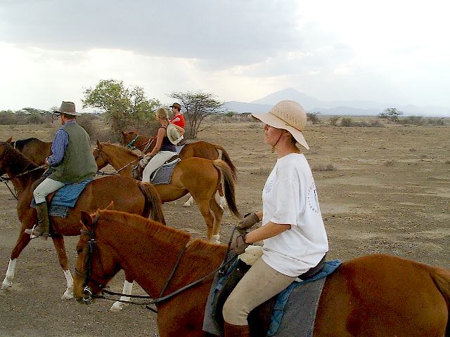
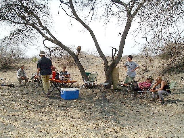
36 degrees, 56.146 East 2 degrees 48.077 minutes South Elevation 3,739 feet above sea level datum.. After lunch and our usual little siesta, John with his stone heavy cast was wrapped in those Masai Red polo wraps and he joined us on the ride. John's horse was really a good animal and seemed to know what was expected of it. I never saw it act up once and it gave John a nice safe ride (far as I could tell). Back home we have a name for a good horse like that: we call them "a packer" and that is high praise for a horse.
We rode and rode and rode. It was getting late and I was afraid we wouldn't make camp before dark. Lise didn't help matters when she told us that a horse punctured the sole of a foot on a sharp rock on the previous safari. The injured horse slowed them down and they had a hard time finding camp in the dark of night. Oh great!! I told her that if I only knew the camp's geographic coordinates (latitude and longitude) I could find it on a moonless night or in thick fog. Darkness or poor visibility would not be a factor because the unit has illuminated navigation screens. I don't think she believed me, but it's true. Well, a few minutes before sundown we made camp (without help from my GPS).
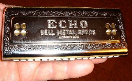
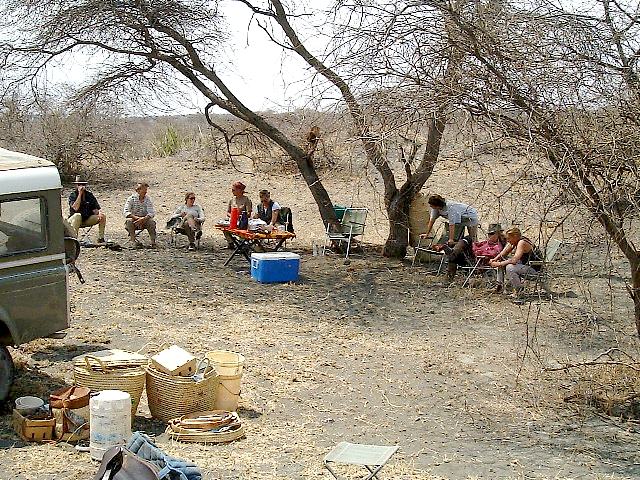
It really didn't matter that we were so close to sundown because everything was all set up for us (as usual). It was pretty late to take a shower, and since I was wearing clean clothes and the ride hadn't been especially dirty or sweaty, I decided I really didn't need a shower - perhaps that shouldn't have been my sole decision - oh well. Most evenings in camp were very comfortable. Only on one occasion could I remember the bonfire being too hot to sit close by. This evening we were out on a more or less exposed plain and it was very nice out. After a good supper we all sat around the fire and had a little drink. While sitting around we found out that John is in some kind of semiprofessional theater organization and sings showtunes. We tried everything to get him to start a sing-along (or a singsong as the Brits put it), but just when I thought he was going to open up, he'd clam up instead. Well, I had no such scruples. I inquired as to the musical tastes of everybody and was quite disappointed to learn that it WASN'T 19'th Century folk music. Rats! Oh well, I went for my harmonicas anyway. I've played a nice large Marine Band for years and I own several different types including a huge chromatic. A few weeks ago I bought a beautiful double sided (C and G) vibrato model. It plays the diatonic scale (do, re, me, fa, etc.) in the keys of C and G but it can't play sharps and flats (that's a chromatic scale). Still, most simple folk tunes and some really beautiful melodies can be played on a diatonic instrument. This harmonica wasn't cheap because it's made in Germany and it has some complex and precision parts. Each note is produced by two reeds that are carefully tuned to very slightly different frequencies. When you have two notes played simultaneously in this manner, you get a mixing effect (called a heterodyne) that, in addition to producing a beautiful double note, also causes the sound to pulsate (called a beat note) thereby producing a vibrato effect. The reeds of my new harp are also very sensitive to breath control so that intensity and duration of the notes are relatively easy to control. I just love playing that harmonica.
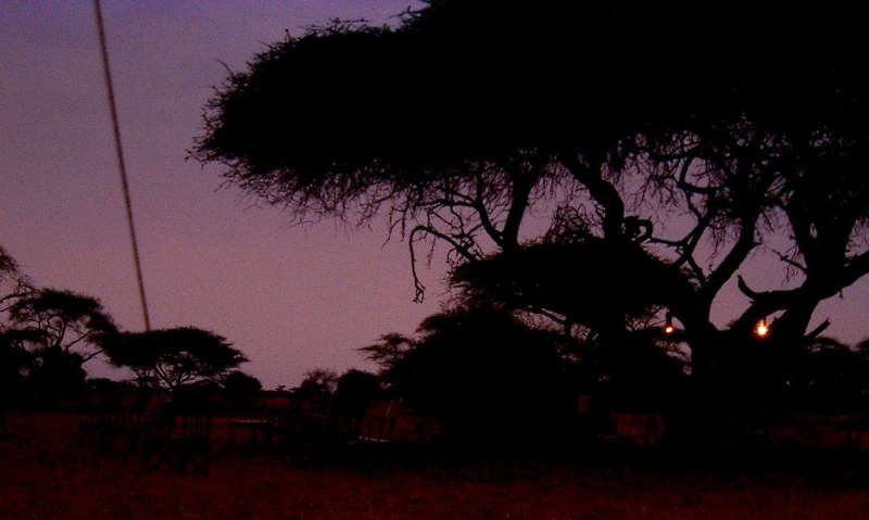
While everybody was engaged in conversation around the campfire, I supplied the background music. Playing out there was a most enjoyable experience and I didn't care if anybody was listening or even wanted to hear my "music," but I think some people liked it. I kept asking people if they recognized beautiful old melodies (from both sides of the Atlantic) like "Anne Loire," "Shannandoah," "Oh The Summer Time is Coming," "Lorena," "Wearing 'O the Green," "Pleasure d' Amour," Etc. but no one recognized a thing until I'd play the Star Spangled Banner or My Country 'Tis of Thee (God Save the Queen). I played Beethoven's Ode to Joy and it was identified as some EEC melody of some sort. Such a shame that so much beautiful old music is unrecognized and unappreciated by young people. On the other hand, if I'd have been a real musician playing a real instrument really well, maybe people would have liked that old music better. Still, I very much enjoyed playing that evening. After playing until everybody was sick of it, I turned in. The sun rose right on time the next morning and we began our last full day's journey. As usual, I got up early to enjoy the pre-dawn sights around camp. The sky was a deep purple and the lanterns were still burning - what a beautiful sight it was. As soon as the sun was up activity in the camp resumed, breakfast was prepared and consumed and the horses were made ready for the day's ride.
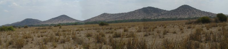
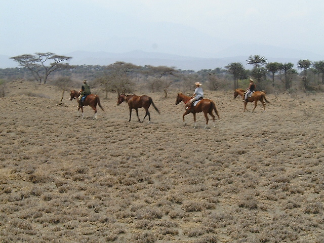
We all mounted up and pretty soon we were heading nearly due south in the direction of Mt. Maru. We were moving roughly parallel, but considerably east of the route we took when we started the trip. The terrain became drier and drier until we were basically riding in a desert of volcanic dust. What little vegetation might have been there had been completely eaten to the roots by the Masai goats. As a matter of fact, we passed some goat herds and for the life of me, I have no idea what in hell they were living on out there.
As we proceeded south and it got drier and drier, we got into an area of a very strange cactus called an Euphorbia tree. If I could have named that plant I would have called it the Menorah Plant because, with its up swept branches, it looked to me like a three dimensional Jewish Menorah.
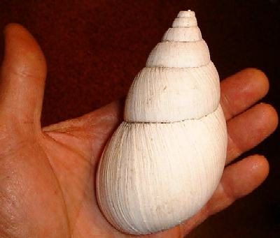
Finally, the land turned to a sterile dark gray dust. As blasted as this region looked, once it must have been lush because here and there were the shells of huge land snails.
We met up with the Land Rover for lunch out here in what looked to me like a god-forsaken place. It was hot out there and very dusty. I had to take special care to protect my digital camera because it is not dust proof. The whole area was rather hilly like low sand dunes (or dust dunes) and it was very easy to loose site of the lunch camp. I wanted to go back for one of those snail shells I'd seen earlier so I took a geographic fix on our camp with my GPS and then started walking back in the direction from which we had come (more or less). I found a couple of those shells and then decided to make my way back to camp. Just for fun, I took a route at an angle from which I came just to make the return more interesting. When I had walked far enough, I took a fix on my location and then had the unit plot a course for me to the camp. I got the direction and distance and then turned the unit off. I took out my compass and then followed the bearing using only the compass. Guess what? When I came in sight of the camp, I was right on the beam. By the way, I found that true and magnetic north were exactly the same there in Tanzania (there didn't appear to be a magnetic declination down there).
Please sign my guestbook before leaving. If you would like to skip ahead, you can return to the Africa Adventures selection page. |