|
AN AMATEUR GEOLOGY
ROAD TRIP
My travels through the Colorado Plateau of southern Utah and northern Arizona. by John Fuhring June, 2010 Page 3  What the Cretaceous swamps on the shores of the Mancos Sea might have looked like The Sevier Highlands are in the background and the open seaway would be to the rear with newly evolved flowering plants and modern looking trees. Yes, that explained the formations to my right, but what about the really scenic, colorful and dramatic structure I was just now entering? What about the Cockscomb and the formations off to my left as I headed north? The Cockscomb is technically part of the "East Kaibab Monocline" which means that before it was all chopped up by erosion, it was a series of layers of rocks that were folded in one direction. This folding was accomplished long after the layers making up the Cockscomb were laid down. This folding occurred some time after the Sevier Orogeny during the Late Cretaceous during what people call the Laramide Orogeny. The Sevier Orogeny involved movements along rather shallow and very low angle faults to thrust old sediments over younger ones and it was confined to the west of the Colorado Plateau with the Plateau region only receiving sediments from the highlands thus created, but not otherwise involved in the faulting. The Laramide Orogeny was something very different. According to those who have worked out all this stuff, the Laramide Orogeny began as the Sevier Orogeny was waining, about 70 million years ago and continued on until about 40 million years ago, long after the dinosaurs all died out. Rather than movement along shallow low angle faults, movement was along deep, high angle really old faults believed to have been active during Pre-Cambrian times, but inactive since while layers of Paleozoic and Mesozoic were laid flat upon them. The fault that lies at the core of the Cockscomb and that runs roughly north and south is one of those faults that extends from the old Pre-Cambrian basement rocks to deep within the crust below. For long ages, this fault remained inactive, but forces related to what was happening on the West Coast with its subduction zone out there, caused these faults to move. This movement was very limited and very mild here and on other parts of the Colorado Plateau gently lifting the Plateau and segments within the Plateau, but without causing a whole lot of distortion of the layers. On the other hand, the movement on old faults within the deep basement rocks was much larger to the east and raised today's Rocky Mountains as large movements on faults raised high mountains and greatly distorted the older layers over there. It is believed that at one time, the region of the Rocky Mountains to the east of the Colorado Plateau resembled the high Tibetan Plateau and what we see today as the Rocky Mountains is the eroded remnants of that ancient plateau. So, how does all that have anything to do with what I was seeing as I entered the Cockscomb and headed north along Cottonwood Wash? Well, when the old Kaibab Fault reactivated sometime in the late Cretaceous or later, the preexisting, flat lying sediments that lay on top of the fault were distorted. The layers to the west were raised up and the layers to the east dropped down -- or at least dropped down relative to the layers to the west. These layers include really old Paleozoic stuff like the Cambrian Tapets Sandstone (at the bottom) all the way to Mesozoic Cretaceous Mancos Shale stuff on top. The movement along the fault was slow enough and the sediments were ductile enough that evidence of faulting within the layers, if it occurred at all, is not visible, but we see only the remains of folded (and eroded) rock layers as the formations were "draped" over the shelf that was created by the fault motion. By now I'm sure that professional and academic geologists have come up with a really learned and totally unpronounceable Latinish/Greekish neologism for this, but in my simple world they are simply known as "drape folds" and that is a good enough term for use in this discussion. So there we have it, the once horizontal layers representing nearly 500 million years of Earth's history were draped over this fault like blankets over pillows on a bed. Ah, but that's where the similarity ends. The Japanese have a very unfortunate saying regarding individualism that is true in their society and, sadly, true even in our own (although we don't like to admit it): "the nail that sticks out gets pounded down." This principle is especially true when applied to geology. In geology it is the topography that sticks up higher than its surroundings -- above the "base level of erosion" -- that gets dissected and worn down by erosion. 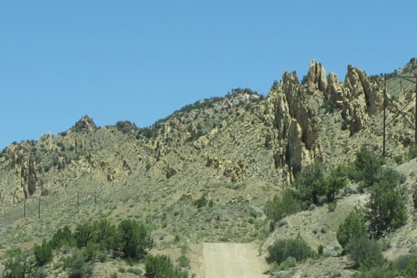 Vertically dipping beds of once horizontally lying sandstones. To understand what you are seeing while driving through the Cockscomb it is necessary to realize that Cottonwood Canyon Road lies somewhat above and a little to the east of the old fault. Off to the west, that was the side that was raised up and being higher, much of the later layers, all the way down to the early Jurassic, were eroded away exposing those formations. To the west of you is the Cretaceous Mancos Shale that wasn't eroded away because it didn't stick up. The sharply dipping beds like the vertical layers shown in the picture above are what's left after erosion has dissected the vertical portion of the fold. 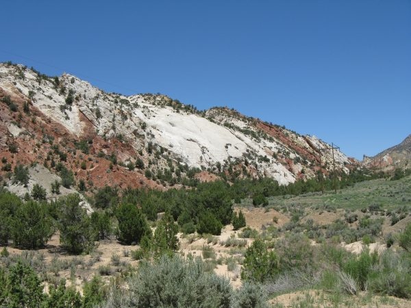 Jurassic rocks "gently" dipping to the east looking north west. 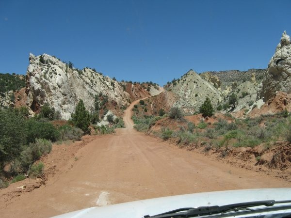 Another part of the fold. Steeply dipping but not yet vertical. Along the Cockscomb and Cottonwood Canyon Road, the age of the rock formations get progressively older not as you go from high to low, but as you look from right to left. If you like to look at interesting geology along a scenic dirt road and don't mind miles of washboard that rattles your very fillings, this is the place. Every mile has its really interesting and beautiful sight. Here I came across a gleaming, cream colored "reef" that looked like it was made out of a fine alabaster. I didn't stop and I have no idea just what it is. 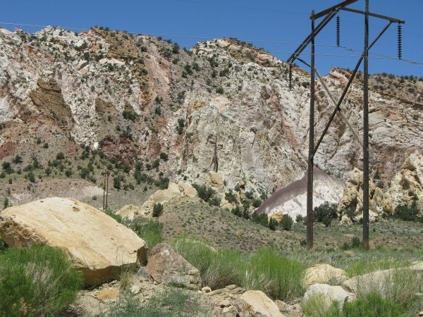 "Alabaster" reef within the Cockscomb 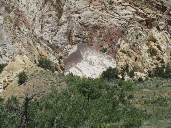 A closeup of the reef. |