|
AN AMATEUR GEOLOGY
ROAD TRIP
My travels through the Colorado Plateau of southern Utah and northern Arizona. by John Fuhring June, 2010 Page 2
Finally I
drove past those hundreds of windmills at the Tehapachi Pass and
descended into the warmth of the Mojave Desert and toward the town of
Mojave. My first indication that I was now in the desert was the
appearance of Joshua Trees. The desert was warm, but not
uncomfortably hot so I just kept my window open. I had planned to
make my first "pit stop" at (what used to be) a very nice rest stop
near Boron, but alas, it was closed and in ruins so I had to make
other
arrangements, somewhat informally, off the highway a bit. For a
hot, dry, out-in-the-middle-of-nowhere place, Boron is kind of
interesting. Nearby is the huge Borax mine and mill and up in the
hillsides, you can see the old test stands where large rocket engines
used to be tested back in the 1950s and 60s.
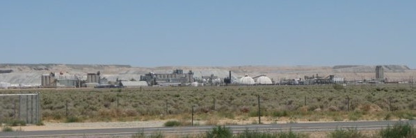 Borax Plant at Boron 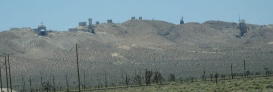 Old Rocket Test Stands near Boron
The "Worlds Tallest Thermometer" at Baker (what a
great name for a place that gets hotter than hell) wasn't working so I
didn't know just how hot it was, but it wasn't too bad and I just kept
my window open. At Baker you pick up highway 15 for Los Vegas
(AKA Lost Wages). I entered the south of Los Vegas and almost
immediately I came to a dead stop on the freeway. There had been
an accident in the northern part of the city and the traffic was backed
clear through the entire city limits. It took two hours to get
through and, with the late start that morning, my Plan A was starting
to look like it might be in serious trouble. Little did I realize
how much in trouble it was.
As I drove along I could see the gray old limestones that had formed in thick layers during the Paleozoic when this part of North America was the continental shelf unlike the Colorado Plateau region which accumulated much thinner and more shallow sediments at this time. These gray old limestones were also resting over much younger sediments. At the nearby Valley of Fire State Park you can see the younger Jurassic Navajo Sandstone (here called the Aztec Sandstone) outcropping under these old limestones. When the limestones were laid down in a tropical sea during the Paleozoic, the West Coast of North America was more like the East Coast today. The active plate boundary and the subduction zone wouldn't be formed until the Atlantic ocean opened up to separate Africa and Europe from North America and push the whole continent to the west later beginning about 200 million years ago during the early Triassic. Massive compressive forces were created by the subduction zone and especially when a island or other pieces of crust would jam on to the western edge to create parts of today's California, Oregon and Washington. These compressive forces bunched up and thrust over these old sediments on top of younger sediments especially during the Cretaceous in what's known as the Sevier Orogeny. As we'll see later, the Sevier Orogeny had profound effects on the geologic history of the Colorado Plateau even though none of the thrust faulting caused by compressive forces at the convergent plate boundary on the west coast got this far east. 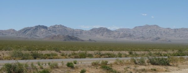 Hills of old Paleozoic Limestones Trilobites from old Cambrian limestones may be found in some outcrops. |