|
AN AMATEUR GEOLOGY
ROAD TRIP
My travels through the Colorado Plateau of southern Utah and northern Arizona. by John Fuhring June, 2010 Page 4
Plan 'A' had originally called for me to stay two days at Zion National Park, only I hadn't counted on the tremendous overcrowding I would find there. The reason Zion had been planned to be the first stop on my trip was that I wanted to get a good look at exposures of important formations and time periods that I would be seeing in other parts of Utah's Colorado Plateau and that way, get them more firmly in my mind. I also wanted to start there to chart the facies changes in such formations as the early Triassic Moenave Formation as it changes from river born sediments to the fossilized sand dunes of the Wingate Sandstone to the north and east. Looking back I kind of laugh at how naive I was to think I could blow in there in the late afternoon without reservations and just hike around as long as I wanted to stay. Briefly, the formations that are so well exposed at Zion and the ones I wanted to see close up to start my trip are as follows from the top on down: The Temple Cap Sandstone. This rather thin formation is found only in the Zion area and it is very similar to the underlying massive Navajo Sandstone. There is an unconformity between the Temple Cap and the Navajo indicating that a major change in climate and deposition was taking place as the last of the Navajo was laid down. Erosion of the Navajo began, but it briefly reversed to deposit the Temple Cap. In the end, a long period of erosion took over and removed the Temple Cap sandstones over the rest of the Plateau along with a lot, but certainly not all of the Navajo and related sandstones. The Navajo Sandstone. The most dramatic cliffs, rising 2,000 feet in places are composed the amazing Navajo Sandstones. These cross-bedded sandstones date from the early Jurassic, but were formed as huge sand dunes in perhaps the biggest desert of all geologic history. Fossilized sand dunes from this time cover a huge area of Western North America and go by various names such as Navajo, Nugget and Aztec sandstones, but they are all formed in the same ancient desert. There is evidence from tiny zircon crystals that much of the huge amount of sand, over 2,000 feet in many places, came from the southern Appalachian Mountains back when they were high peaks and the sand was carried in large rivers nearly as long as the modern day Amazon and Nile only to be picked up by the wind and blown into dunes as the rivers dried up at the edge of a scorching desert. As thick and hard as this sandstone appears, the grains are held together by calcite instead of silica and it is not as hard and weather resistant as it looks. It does form huge vertical cliffs in the climate of this region though. The Kayenta Formation. The change from Navajo to Kayenta below it is easy to spot although it is obvious that the change from Kayenta to Navajo climate took a while to accomplish as there are "tongues" of Navajo looking stuff in the upper layers. The red Kayenta tends to form thin ledges of thin limestone separated by thicker layers of mudstones that contain fossilized dinosaur tracks and mud cracks. It is thought that this area had a climate similar to today's northern Tanzania with its seasonal flooding and drying. Of course, the analogy is not perfect because that part of Africa is in or adjacent to the African Rift and the Zion Park region was not part of any such rifting during the Jurassic. The Moenave Formation. The early Jurassic and very red Moenave formation is the lowest layer exposed in the Park. This is an interesting formation that was evidently laid down as sand and mud in river channels and floodplanes. To the north and east of here the rivers evidently dried up and their sand was picked up by the wind and blown into dunes to form the contemporaneous Wingate Sandstones. Later the Moenave and the Wingate dunes were covered by the stream and lake deposits of the Kayenta as climatic conditions changed. It is thought that much of the sand these rivers carried and which formed the fossilized dunes of the Wingate came all the way from the early Appalachian Mountains. Here are a few scenes from when the geology field trip visited Zion back in 2005. The first stop we made on entering the Park from the east on Highway 9 was the Canyon Overlook Trail. This is an easy trail that leads from a small parking area out to a cliff where you can see massive cliffs of Navajo sandstone with the Temple Cap sandstone in the distance and all the other formations too. Certainly one of the most rewarding hikes we took on the entire trip. 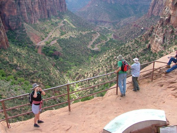 Arrival at the end of the Canyon Overlook Trail. The road below exits the long tunnel through the sandstone to the left and proceeds down to the valley floor. 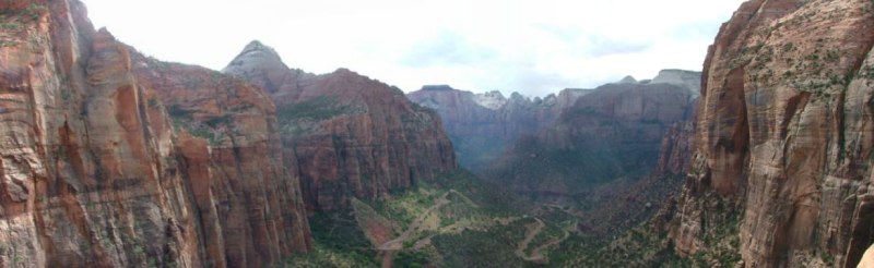
The scene from the Canyon Overlook Trail.
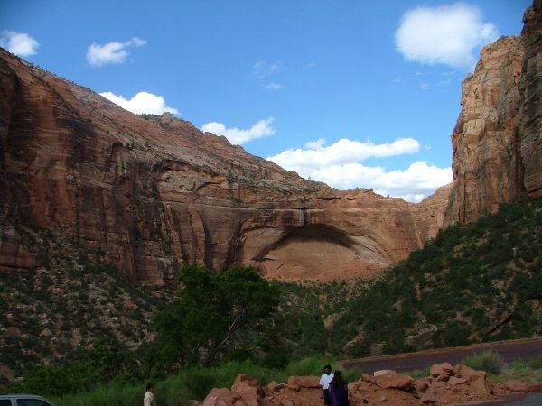 Looking back up at the Trail from the road. 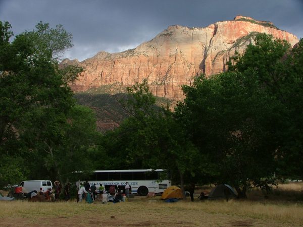 Our camp at Watchman was surrounded by high sandstone cliffs that remained illuminated into the late evening hours. The weather was unsettled when we arrived at Zion. There was even a couple of loud thunder claps that really echoed up and down the canyon. That night it rained and so I had to scramble out of my nice dry tent to help erect tents and put other people's guitars, sleeping bags and other things under shelter. One of the big reasons I avoid "sleeping under the stars" when I go camping. The next day the "slickrock" formations were indeed slick with rain and we canceled the plans for a unnamed, but "special" hike that had been planned for that day. I think it was to a really scary place called "Angles Landing" way, way up on a fin of sandstone. I, for one was glad it was canceled. In fact, I made up an old saying about the place: "Just one easy landing for an angle, but one long hard fall for a man." We went to the beautiful lodge building at the center of the canyon and had our wrap-up lecture there in an unused auditorium. It was too wet to have it out doors. 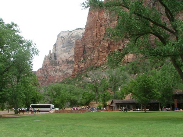 Park buildings and lodge surrounded by massive sandstone towers. I wanted to do something else besides wander around the floor of the canyon so I took the "Emerald Pool Trail" up to the ... ah.. Emerald Pool. 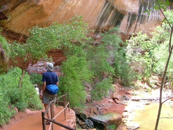 Along a "tongue" of Navajo-like sandstone in the Kayenta Formation formed a ledge along the trail. 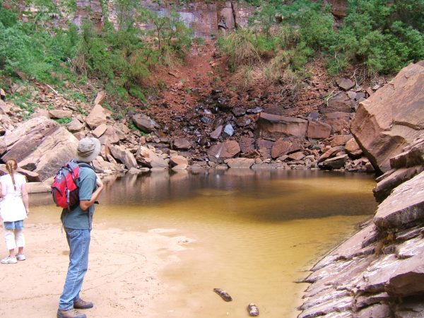 When we got to the "Emerald Pool" we discovered it had been misnamed. It should have been called the Topaz Pool. |