|
AN AMATEUR GEOLOGY
ROAD TRIP
My travels through the Colorado Plateau of southern Utah and northern Arizona. by John Fuhring June, 2010 Page 2
Back to the trip. From Kanab its 45 miles east on Highway 89 to the turn on to Cottonwood Canyon Road. 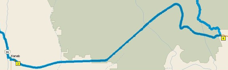 Route from Kanab to Cottonwood Canyon Road.
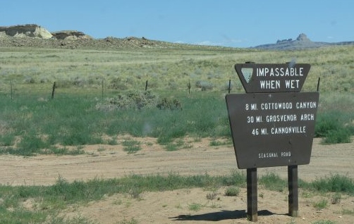 The sign from the highway is easy to miss. 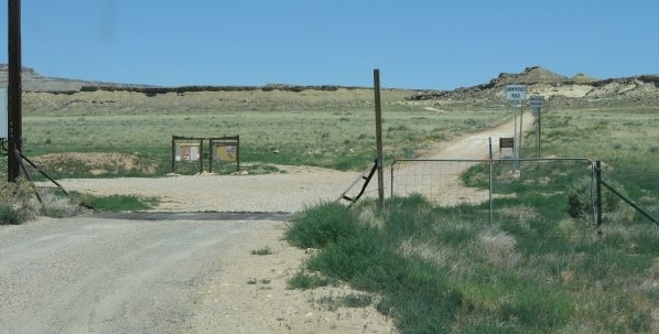 What looks like any deserted dirt road out in the middle of nowhere. The road out to the Cockscomb and on up to Kodachrome Basin is dirt and the turn north is easy to miss, but I had it all programmed into my GPS so all I had to worry about was the high speed traffic behind me as I waited for a break in the oncoming traffic to turn left. Once on the dirt road, the first few miles were kind of boring with what looked like Cretaceous Mancos Shale type rocks outcropping. 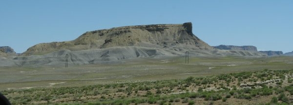 Buttes of gray Cretaceous sediments laid down in the Mancos Sea. I looked for any seams of coal from the swamps of this era, but didn't spot any. Pretty soon the washboard road led to the Cottonwood wash which runs down the center of the Cockscomb flowing south. 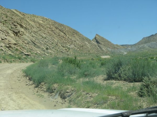 Tilted layers on the east side of the East Kaibab Monocline. Already I was
seeing the eroded remains of the "drag fold" that was created when
older sedimentary rock layers were deformed and folded when movement
occured on a old paleozoic fault (to the left of this photo) during the
Larmide Orogny about 70 million years ago.
I'd like to mention that there are two faulting events that are very important when considering the development of the Colorado Plateau. The somewhat older event that led to the formation of the Great Western Inland Sea that bisected North America from the Artic Ocean to what's now the Gulf of Mexico and led to the deposition of the thick shales, sandstone and coal of the Mancos Sea is called the Sevier Orogeny. This is named after the Sevier River in Western Utah where the evidence of that mountain-building event was first studied. During the Sevier Orogeny thick layers of old Paleozoic sediments - mostly limestones - where shoved over younger Mesozoic sediments (like the Navajo Sandstone). This thrusting of old sediments over younger sediments is believed to have been caused by compressive pressures to the west caused by the West Coast of North America colliding with islands and other seafloor debris jammed onto what would later be California as the seafloor plate to the west was subducted under the West Coast. As the material carried on top of the seafloor encountered the subduction zone, it was too light to be subducted under so it jammed onto the growing coast. Of course, all this jamming caused huge compressive forces that jammed the stuff to the east up and over other older formations along very low angle (nearly horizontal) faults. Back in the dark ages when I was taking my geology courses I heard rumors of the early work they were doing trying to understand the low angle thrust faults along the Sevier River in eastern Utah, but, to tell the truth, I considered the possibility that huge mountains of stuff could be thrust over younger sediments to be just plain absurd. No way could it happen. Well, the evidence is there that it did happen and evidently the thrust forces were not deep in the crust, but relatively near the surface and the layers of Paleozoic limestones were weakly attached to each other allowing a relatively low friction movement to occure. The result of the creation of these thrust fault mountains in eastern Utah and western Nevada was two things. First all this thickening of the crust to the west weighed down the crust so that it warped downward to the east creating the Great Inland Sea or, what I like to call, the Mancos Sea. As mentioned, the Mancos Sea and its shores were the perfect environment for the swamp forests and a hog-heaven habatat for the early and middle Cretaceous dinosaurs. As these sediments were buried they became the Mancos and Tropic marine shales and sandstones and the swamp forests with their accumulated thick organic material became the coal seams within theses formations. |